
Researchers have developed a new AI model that can monitor satellites and detect anomalies in their behaviour, significantly reducing the risk of in-orbit collisions. This tool, part of the AI4 Space Safety and Sustainability project, learns from satellite light reflections to predict motion and identify unusual activity, crucial for managing the increasingly crowded space environment.

It is about proving that the agency can still deliver when the stakes are high.

The Swadeshi Jagran Manch (SJM) has urged the Indian government to deny permission to Elon Musk's Starlink for commercial satellite broadband services, citing national security concerns. The RSS-affiliated organisation highlighted issues with data bypassing Indian gateways and the potential for misuse by hostile actors, advocating for indigenous solutions.

Researchers from IIIT-Delhi and MS Swaminathan Research Foundation have developed SICKLE, a multi-satellite dataset designed to enhance AI systems' ability to monitor crops, identify growth, and estimate yields across vast agricultural areas. This dataset combines satellite imagery with field-level information, enabling machine learning models to understand various aspects of crop cultivation and predict key parameters like phenology and productivity.

Chinese officials warn that glaciers on the Tibetan Plateau are becoming increasingly unstable, leading to a higher risk of flash floods and other disasters, as evidenced by a recent deadly ice-rock avalanche near the Nepal-Tibet border. The region has seen a significant reduction in glacier area, and scientists are calling for advanced monitoring systems to predict these complex events.

'With this deal, we may see even 50 launches a year within the next few years.'

A powerful magnitude 7.0 earthquake struck China's Tibet region on Thursday, resulting in at least 16 fatalities and 54 injuries. The quake, with its epicentre east-northeast of Nagqu city, caused significant damage, including the collapse of 339 houses, and led to the suspension of train services. Rescue operations are underway, with Chinese President Xi Jinping calling for all-out relief efforts.

A senior Geological Survey of India official warns that the Himalayas are vulnerable to cascading disasters, where one high-altitude event can trigger a chain of destructive events downstream, as evidenced by Nepal's recent floods. He stresses the need for integrated monitoring using satellite data and ground investigations to identify high-risk areas and improve preparedness in the Indian Himalayas.
Technopark-based space-tech startup HEX20 has been selected by the UAE Space Agency to develop a spacecraft for an asteroid probe, marking the first time an Indian private company has been chosen for a deep-space mission by the Gulf nation. HEX20 is contributing its expertise in developing the spacecraft bus and software for the Emirates Mission to the Asteroid Belt, which is scheduled for launch in March 2028 to study asteroid 269 Justitia.

'I don't think the government will sacrifice such a fine institution for monetary gains.'

'ISRO will not manufacture any launch vehicles. That will all be done by the private sector or public sector undertakings.'

This might lead to a further outburst, flooding downstream if left unchecked.

'When a glacier collapse or a major flood event does occur, the water will simply reclaim its original path, and anything built in that path will be swept away.'

China has issued a Level-IV alert due to a newly formed barrier lake at the Tibet-Nepal border, warning of a high risk of breaching and flooding downstream areas. The lake, formed at the confluence of Chhochen Khola and Purepu Tsangpo rivers, has accumulated an estimated two million cubic metres of water, with inflows expected to increase, raising concerns for areas including Gyirong Port.
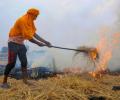
The Commission for Air Quality Management (CAQM) has directed Punjab, Haryana, Uttar Pradesh, and Rajasthan to implement drone-based surveillance to monitor and prevent stubble burning. This initiative aims to counter late-evening burning incidents that evade satellite detection, leveraging drone technology for real-time monitoring, accurate detection, and evidence collection to ensure effective enforcement against agricultural residue burning.

Sikkim has identified 40 high-hazard glacial lakes, with 16 at the highest risk of catastrophic outbursts. Following a devastating GLOF in 2023, the state is developing India's first dedicated GLOF Risk Mitigation Protocol, using advanced monitoring and interdisciplinary approaches to protect downstream settlements and serve as a model for other Himalayan regions.

Scientists are examining how a possible glacial collapse and ice-rock avalanche may have triggered the devastating flash floods along Nepal's Bhote Koshi River, with preliminary assessments indicating that debris may have temporarily blocked the Lhende River and created a landslide dam that subsequently gave way.

'Today, as I look at our satellite -- tested, finished and ready to ship -- represents 1,642 days of grit and belief.'

Researchers at IIT Mandi have developed a real-time landslide monitoring and early warning system that has been deployed in landslide-prone areas of Mandi district, Himachal Pradesh. The system uses machine learning and sensors to detect ground movements and provide early warnings to authorities and the public.

US President Donald Trump on Friday (local time) said the United States could "hit" Iran's heavily fortified underground nuclear site known as Pickaxe Mountain "very soon", days after Washington targeted Iranian military targets.

'The Indian private space sector is no longer a high-risk bet; it is a highly bankable, globally competitive asset class capable of easing the global small satellite launch bottleneck.'

'The valley is around 16 km from the Nepal border, and it took just 8-10 minutes for the ice and rocks to reach the Nepal border. You can imagine how fast it must have travelled!'

India's government has implemented stringent new regulations under the Telecommunications Act 2023, mandating that all communication infrastructure providers, including those utilising cloud-based networks, must store telecommunication data exclusively within the country, a move expected to significantly impact domestic data centre demand.

Nepal's former Forest and Environment Minister Madhav Prasad Chaulagain has expressed concern over the lack of timely information exchange with China ahead of the devastating floods, stating that the disaster's scale could lead to an 'unbelievable' rise in the death toll.

Based on the broadcast visuals, a rocket expert said the failure appeared similar to the anomaly seen during the PSLV-C61 mission.
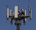
The Department of Telecommunications (DoT) has introduced a new authorisation regime, replacing multiple licences with a single permission for principal telecom services, aiming to simplify compliance and accommodate evolving technologies. This move is expected to ease business operations, enhance fraud prevention with AI, and expand connectivity, especially through satellite networks.

The Department of Space has directed that requests for voluntary retirement or resignation from Group 'A' Scientific and Technical personnel associated with the prestigious Gaganyaan human spaceflight programme and other important missions should not be accepted as a matter of routine.

Weighing 190 kg, Mission Drishti is India's heaviest privately developed Earth observation satellite.
US-Indian space company Pixxel has partnered with Bengaluru-based artificial intelligence firm Sarvam to build an orbital data centre satellite.

The weather office has warned that the prevailing monsoon conditions could trigger flash floods, landslides, waterlogging and a further rise in river levels across the Northeast.

The CMF Watch 3 Pro, from Nothing's sub-brand, offers a vibrant AMOLED display, AI-powered features including ChatGPT support, comprehensive wellness tracking, and an impressive 13-day battery life, retailing in India from 6,999.
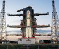
The imaging technology in Nisar can provide very high-resolution data on changes as small as one centimetre in size on the earth's surface.

India and the US on Wednesday marked their maiden space collaboration with the successful flight of a GSLV rocket that placed an earth observation satellite, jointly developed by the two space agencies, in a precise orbit.

Former IPL commissioner Lalit Modi has sensationally revealed that life-threatening intimidation from underworld don Dawood Ibrahim and his crime syndicate was the primary reason for his permanent retirement from cricket administration. Modi detailed how his unyielding stance against match-fixing and refusal to cooperate with the D-Company's multi-billion-dollar betting empire led to direct threats, including a phone call from Dawood and subsequent assassination attempts.
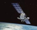
Pixxel has raised $95 million in funding and with the company's commercial Firefly satellites up in orbit selling data globally 'we know and seen what it takes to make this business work.'
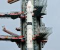
The main focus of the all weather RISAT-1B satellite will be to observe the Indian land with its C-band synthetic aperture radar.

"If we have to ensure the safety of our country, we have to serve through our satellites. We have to monitor our 7,000 km seashore. We have to monitor the entire northern part continuously. Without satellite and drone technology, we can't achieve that."
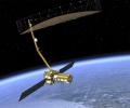
NISAR will not be used for surveillance and will be used to observe the earth.
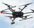
The same technologies that enable State forces to monitor and strike insurgent camps are now being mirrored by non-State actors with increasing sophistication.

The scorching summer heat is frying these Indian towns and cities.
