
The India Meteorological Department (IMD) on Monday issued a warning of significant rainfall in Kerala due to cyclone Fengal, currently positioned as a strong low-pressure area over northern Tamil Nadu.

Dense fog disrupted operations at Delhi airport, leading to cancellations and delays of hundreds of flights. Airlines are offering refunds and rescheduling options.

Retail sales of vehicles across categories in India in 2025 grew by 7.71 per cent at 2,81,61,228 units as compared to 2,61,45,445 in 2024, with GST 2.0 helping overcome a subdued start to the year, Federation of Automobile Dealers Associations said on Tuesday.

The record monsoon rains across India during the June to September months was 937.2 millimetres, the 5th-highest since 2001 and 38th-highest since 1901.
Cyclone Ditwah is moving towards the Tamil Nadu coast, bringing the threat of heavy rainfall. The state government is reviewing preparedness measures, and a red alert has been issued for southern and delta districts.

The India Meteorological Department (IMD) has issued a 'red alert', warning of extremely heavy rainfall in Mumbai, Thane, Raigad and Palghar districts on Sunday, extending the wet patch in the region.

A severe cold wave has gripped North India, with temperatures plummeting to near-freezing levels in several areas. The cold wave has disrupted daily life, with dense fog affecting visibility and forcing people to stay indoors.

Delhi choked under a thick blanket of smog on Monday, with the Air Quality Index (AQI) settling at 498, which falls in the higher spectrum of 'severe' category.

The India Meteorological Department (IMD) has predicted above-normal rainfall for most parts of India during the post-monsoon season (October to December), except for some areas in the northwest. The southwest monsoon season ended with the country recording eight per cent above normal rainfall.

The Baan Ganga entry point wears a deserted look after the Mata Vaishno Devi Shrine Board orders suspension of the Vaishno Devi Yatra from October 5 to 7 due to the IMD's inclement weather advisory for Katra.

The IMD said that rainfall over India in August and September would be around 106 percent of the long-period average of 422.8 mm.

June rainfall accounts for 15 percent of the total precipitation of 87 cm recorded during the four-month monsoon season in the country.

According to weather officials, wind speeds along and off the Odisha-West Bengal coasts are anticipated to reach 60 km/h from October 23, increasing to 120 km/h from October 24 night to October 25 morning.

Several parts of Mumbai received heavy rainfall in the last 24 hours, with Vikhroli reporting the highest downpour. The IMD reported significant rainfall in various areas of the city.

Heavy rain lashed Delhi, leading to waterlogging and traffic disruptions. The IMD issued an 'orange' alert, warning of more rainfall.
The wind speed, reaching 45-55 kmph and gusting to 65 kmph, is likely to prevail over the North Maharashtra coast between October 3 and 5.
The Army unit deployed in Ashti successfully evacuated 40 people with the help of an NDRF team and other agencies.

Heavy rains caused severe waterlogging, traffic jams, and disruptions to local train services in Mumbai. Schools and colleges were closed due to a 'red alert' issued by the IMD.

Heavy rains lashed Mumbai, slowing traffic and affecting train services. The IMD has issued an 'Orange' alert, advising citizens to stay indoors.

Cyclone Ditwah exits Sri Lanka after causing widespread destruction and over 120 deaths, heading towards the Indian coast. Heavy rains and high winds are expected to continue.

The first cloud-seeding trial has been conducted in parts of Delhi, including Burari and Karol Bagh areas, aimed at inducing artificial rain to tackle air pollution.

Heavy rains continue to batter Tamil Nadu, causing a rise in reservoir levels and prompting a red alert. Schools and colleges are closed in several districts as authorities prepare for potential flooding.

IMD officials said the maximum temperature in the three districts could go up to 38 degrees Celsius.

Some India states are likely to record a significantly higher number of heatwave days, according to the national weather body.

Lightning claims more lives in India annually than any other extreme weather event. Between April and July this year alone, 1,621 people died due to lightning strikes.

The IMD has red and orange alerts for the hours ahead.

In a notice, IMD said, 'VSCS BIPARJOY over east-central Arabian Sea, lay centred at 0530hrs IST of 08th June, near lat 13.9N & long 66.0E, about 860km west-southwest of Goa, 910km southwest of Mumbai, would intensify further & move north-northwestwards.'

This would be the second cyclonic storm in the Arabian Sea this year.

Heatwave conditions have been prevailing in Odisha since April 15 and the Gangetic West Bengal since April 17, according to the MeT department.

A landslide in the Vikhroli suburb of Mumbai killed two people and injured two others after heavy rains caused soil and stones to collapse on a hut.

The death toll from landslides in Darjeeling, West Bengal has risen to 24, with rescue operations continuing amidst challenging conditions. Thousands of tourists are stranded as roads remain blocked.

Kerala Chief Minister Pinarayi Vijayan on Wednesday termed as 'baseless', Union Home Minister Amit Shah's claim that the state government did not heed the Centre's warning regarding a possible natural calamity in Wayanad due to heavy rains.

India has received 20 per cent less rainfall since the start of the monsoon period on June 1, with the rain-bearing system making no significant progress between June 12 and 18, according to the India Meteorological Department (IMD).
The last time the southwest monsoon arrived earlier than in 2025 -- that is, back in 2009 -- the rains lost steam after the early onset and ended the season with almost 23 per cent deficient rainfall, which was the lowest recorded average rainfall in several decades over India.

IMD data shows in the 24 hours between September 1 and 2, Haryana received 806 per cent more rainfall than normal, Punjab 759 per cent, Himachal Pradesh 510 per cent, Delhi 740 per cent, Chandigarh a staggering 1,638 per cent, and Rajasthan 193 per cent.
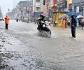
Mumbaikars woke up to very heavy rainfall on Monday, while the India meteorological department (IMD) issued a 'red' alert, forecasting extremely heavy rains at isolated places in the city and adjoining areas, prompting the civic body to declare a holiday for schools and colleges, officials said.

India is set to experience extreme heat during the April to June period, with the central and western peninsular parts expected to face the worst impact, the IMD said on Monday as the country prepares for seven-phase general elections from April 19.

Heatwave may abate over most parts of North India in next two days; temperatures likely to drop by 2-3C.

Various parts of Surat were flooded after incessant rainfall in the region. Over 100 mm of rain has blocked roads and led to waterlogging in several low-lying areas.

The southwest monsoon has arrived in Mumbai 16 days before its usual date, making it the earliest arrival since 1950. This early onset follows the monsoon's arrival in Kerala, the southernmost state, on Saturday, marking the earliest arrival since 2009. The India Meteorological Department (IMD) predicts an above-normal rainfall for the 2025 monsoon season, with rainfall between 96 per cent and 104 per cent of the 50-year average of 87 cm considered 'normal'. The monsoon is crucial for India's economy, providing vital water for agriculture and replenishing reservoirs.
