
The system, which moved towards Bangladesh from north Bay of Bengal at a speed of 56 kmph caused moderate to heavy rain and squally weather in West Bengal's coastal districts of South 24 Parganas, North 24 Parganas and Purba Medinipur, dampening festive spirits on Deepavali and Kali Puja.

The IMD defines a normal monsoon as one which delivers between 96 and 104 per cent of the 50-year average rainfall for the season.

States have been told to prepare in advance to counter any impact of an adverse southwest monsoon.

The India meteorological department said another western disturbance is likely to bring storms and rain to the northern plains, including Delhi, over the next few days.

The duo used their mobile phone to establish contact for their rescue, following which an NDRF team was roped in.

The onset of the southwest monsoon is being keenly watched this year as it may provide an early sign regarding its progress over the Indian subcontinent, particularly when El Nio is expected to rear its head during the latter half of the season.

Commuters on some routes, including the Harbour line that operates services between Panvel and Chhatrapati Shivaji Maharaj Terminus (CSMT), complained of delay in train operations in the morning hours.

A 22-year-old person was killed and another one injured on Thursday after a tree fell on their hut in Mumbai as moderate to heavy rains lashed the city and its suburbs in the last 24 hours, officials said.

It said the weather system was expected to intensify into a deep depression by 5.30 am on Wednesday and turn into Cyclone Mocha in the next 12 hours, packing wind speeds of 80-90 kmph and gusting to 100 kmph.

The local train traffic on the Central and Western Railway routes was mostly normal though the trains were running a few minutes late, railway officials said.

The country received 16 per cent more rainfall than its normal limit in June, the IMD on Tuesday said.

Rijiju, who was removed as law minister on Thursday, refused to answer questions about his previous ministry contending that they were no longer relevant and that he looked forward to serve in the Earth Sciences Ministry.

The IMD has issued Yellow alert for Thiruvananthapuram, Kollam, Pathanamthitta, Alappuzha, Kottayam, Ernakulam, Idukki, Thrissur, Malappuram and Kozhikode districts for today whereas Wayanad too has Yellow alert on May 22.

'While every year presents new challenges, it also provides opportunities for better growth and performance.'

The event, for which people had started gathering since morning, began around 11.30 am and went on till around 1 pm. That day, the nearest weather station to the spot of the programme recorded a maximum temperature of 38 degrees Celsius.

The cyclone is expected to make landfall on Thursday evening as a 'very severe cyclonic storm' with maximum wind speed reaching up to 150 kilometres per hour, the India Meteorological Department (IMD) said.

As the heavy rains continued on Wednesday also, Orange alert was sounded in 12 of the 14 districts of the state for the day.

The weather system moved west-northwestward and concentrated into a depression on Saturday at 8.30am, close to west of Andaman Islands, the bulletin said.

After a stellar run on the bourses that saw tractor stocks rise up to 52 per cent, analysts are turning cautious on the sector as muted demand trends may weigh in the near-term. Total volumes in the tractor segment for the last three quarters of the current financial year (9MFY24) have remained weak with VST Tillers, Escorts Kubota, and M&M seeing declines of 21 per cent, 5 per cent, and 3 per cent year-on-year (Y-o-Y), respectively, during the period, amid patchy rainfall, delayed crop harvest, and lower reservoir level. Across industry, total domestic sales volume so far in the current financial year (April '23 to January '24) has declined 5 per cent Y-o-Y, as per Tractor Manufacturers Association (TMA).

The India Meteorological Department said the southwest monsoon further advanced into Delhi, Uttar Pradesh, Himachal Pradesh, Jammu and Kashmiri, some parts of Punjab, Haryana and Rajasthan on June 30.

This time, Delhi saw a sharp improvement in air quality just ahead of Diwali which can be attributed to intermittent rainfall on Friday and wind speed favourable for the dispersion of pollutants.

A siren giving a warning about tsunami erroneously started playing from the Early Warning Dissemination System at Porvorim near Panaji, triggering panic among the local residents, an official said on Thursday.

The rains were being caused due to a cyclonic circulation lying over north east Arabian sea and adjoining Saurashtra and Kutch regions, the IMD said in its bulletin.

The capital witnessed a clear morning on Friday with the minimum temperature settling a notch below normal at 14.6 degrees Celsius.

Wind speed at the time is expected to be in the range of 125-135 kmph gusting up to 150 kmph.

Such weather conditions are not typical for May which tends to be the hottest month of the year in Delhi with a mean maximum temperature of 39.5 degrees Celsius.

Just two days after recording 811.6 mm of rainfall in a day, Cherrapunji in Meghalaya received a bountiful 972 mm of precipitation in 24 hours ending 8.30 am on Friday, the highest in June since 1995 and the third highest in 122 years, the India Meteorological Department (IMD) said.

Officials in coastal Devbhumi Dwarka said around 1,300 people have been shifted to safer places so far.
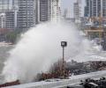
Several major cyclones have hit various parts of India over the last 10 years. Here is a look at the notable among them.

Cyclone Biparjoy made landfall near Jakhau Port in Gujarat on Thursday evening with a wind speed of 115-125 kmph gusting to 140 kmph as heavy rains lashed the coastal region, where several areas plunged into darkness due to power cuts and a large number of trees, electric poles and hoardings got uprooted.

Mumbai, its satellite cities, north and central Maharashtra and south Gujarat received rains on Wednesday owing to a low-pressure area in the Arabian Sea and a western disturbance, the India meteorological department said.

Severe cyclonic storm Mandous will cross the coast between north Tamil Nadu and south Andhra Pradesh around December 9 night and early next day, the regional weather office said on Friday.

The India Meteorological Department's (IMD) regional centre for Mumbai has issued a 'yellow alert' for next three days, predicting heavy to very heavy rainfall at isolated places.

According to Indian meteorological department, tremors were felt in Bihar, Uttar Pradesh, Jharkhand, Rajasthan, Haryana and Punjab, lasting for a minute, triggering panic and forcing people to rush out of their homes and offices. There was no official word about casualties from any of the states but reports from West Bengal said cracks appeared in several multi-storeyed buildings in Siliguri in north Bengal. An incident of wall collapse was reported from Telipara in Jalpaiguri district.

'AI can be very useful for making analysis and especially making city-based local forecasts.'

A severe cold wave brought the minimum temperature down to a numbing 1.5 degrees Celsius at the Ridge weather station in central Delhi.

A cyclonic circulation lies over north coastal Tamil Nadu, southeast of Bay of Bengal and a low pressure area is likely to form by November 9, the Meteorological department said on Sunday and has forecast widespread rainfall for at least the next three days in the state.

The southwest monsoon has started on a weak note and this has delayed the sowing of kharif crops. Though a cause for concern, the situation hasn't reached a stage where it warrants any panic response. Moreover, according to meteorologists and industry players, monsoon rains will witness a revival in the coming few weeks.

The IMD said that there has been an increase in the rainfall activity in Kerala and monsoon could hit the state anytime now.

Kerala has been receiving rainfall since Saturday and 10 out of the 14 weather monitoring stations in the state have received more than 2.5 mm rains.
