Out of its 47 operational satellites, India currently has six to eight satellites which are used entirely for military purposes.
T E Narasimhan reports.
The recent air strike by the Indian Air Force in Pakistan’s Balakot, which caught the attention of the entire country, was certainly a terrific example of the capability of the country’s armed forces.
However, the dramatic strike was also aided by the information and images received from the ring of all-seeing radar imaging satellites built by the Indian Space Research Organisation.
For the last few years, these satellites have been constant sentinels in our skies and have given ground information to an extent not possible earlier.
For example, the Cartosat 2-series of satellites played a key role in assisting the armed forces in the surgical strike of 2016.
From its perch in the sky 526 km above the earth, and rotating around the earth every 90 minutes, this bird can peer at every object in Pakistan and can even count the number of cars parked in the grand mansion of the Pakistani prime minister.
With an almost 0.65-m resolution, it can count every tank, truck and fighter aircraft parked anywhere in Pakistan, or for that matter anywhere else, say experts.
Out of its 47 operational satellites, India currently has six to eight satellites which are used entirely for military purposes.
And coming up now is a slew of new satellite launches by the ISRO which will significantly enhance the country’s radar imaging technology.
These satellites will not only provide more “eyes in the sky” in order to track terrorist launch pads and hideouts, they will also help to monitor activities in the Indian Ocean, especially those by Chinese warships, give precise data on weather and map affected areas during natural disasters.
“Science and technology are an essential component for the development of any country and plays a major role in improving the quality of life including safety and security of human beings,” says ISRO chairman, K Sivan.
This year, ISRO is looking at a minimum of 32 planned missions, including 14 launch vehicles and 17 satellites.
It plans to reinstate its microwave remote-sensing capability through the RISAT (Radar Imaging Satellite) series, and attain operational geo-imaging capability through the GISAT (GEO Imaging Satellite) series.
With the launch of GISAT-1 in September and GISAT-2 in November this year, India hopes to acquire the capability to get high resolution imageries quickly during natural disasters.
The GISAT series of satellites carry geo-imagers with multi-spectral (visible, near infra-red and thermal), multi-resolution (50m to 1.5 km) imaging instruments that will enhance the country’s land mapping capabilities.
So far, satellites could survey a specific area only every 22 days.
The GISAT satellites will scan an area every alternate day and provide nearly real-time pictures of large areas for border surveillance.
During the recent floods, ISRO’s earth-based satellites were monitoring the flood situation which helped to effectively conduct the relief work.
Oceansat-2, Resourcesat-2, Cartosat-2 and 2A and INSAT 3DR sent data to provide alerts on flooding, areas of inundation during and after the rains, and weather forecasts.
INSAT-3DR, an advanced meteorological satellite, is equipped with an imaging system and an atmospheric sounder which provides data on temperature and humidity for weather forecasts.
Cartosat and Resourcesat capture high resolution images that help send out early flood warnings and map affected areas.
The launch of GSAT-20 later this year is geared to help India meet the high bandwidth requirement of Digital India and also power in-flight connectivity.
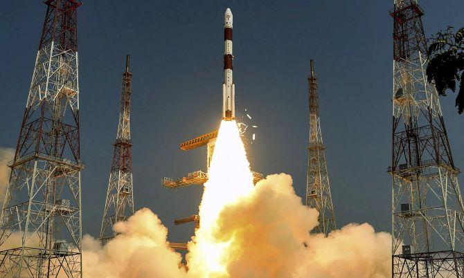
Cartosat-3, slated for launch this month, has a stunning resolution of 0.2 meters and powerful multi-spectral (captures light within specific ranges in the electromagnetic spectrum) and hyper-spectral (captures light from across the electromagnetic spectrum) capabilities.
In April, India also launched the country’s first electronic surveillance satellite, EMISAT which will help detect electronic signals on the ground, especially hidden enemy radars.
Jointly developed by the ISRO and the Defence Research and Development Organisation, this advanced electronic intelligence (ELINT) satellite, along with the AWACS (Airborne Warning And Control System), would work as a vital tool for India to locate, tackle and silence enemy radars and secure the country’s airspace.
That’s not all.
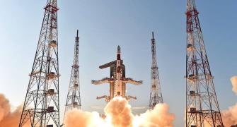
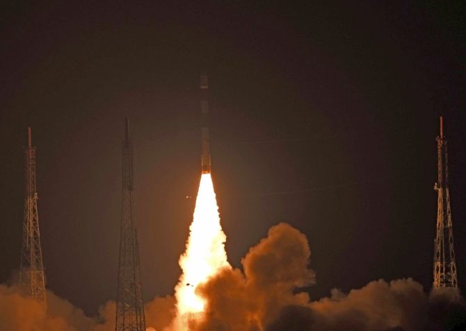
Last month, India launched RISAT-2B, an all-weather satellite which replaced its predecessor RISAT-2.
ISRO’s Sivan says that this sophisticated earth observation satellite uses a synthetic aperture radar which gives precise details, including size of objects, structures and movement.
The ISRO developed the satellite’s hi-tech antenna indigenously and in a record time of 13 months.
The ISRO has also launched communication satellites GSAT-7 and GSAT-7A for the Navy and the Air Force.
GSAT-7A, launched last November, has boosted drone operations as it is helping the IAF upgrade from existing ground control stations to satellite-control of military unmanned aerial vehicles.
Then there are some satellites which have dual use.
For example HysIS (hyper-spectral imaging satellite), launched last November, can see through soil to detect landmines.
Ratan Shrivastava, an aerospace and defence expert, says that strategic satellites are game changers, providing the fourth dimension of spatial technologies to enhance the classic land, sea and air capabilities of the Indian defence forces.