
India recorded 125 extremely heavy rainfall events during September and October of 2021, the highest in five years, owing to late withdrawal of the southwest monsoon and higher-than-normal low-pressure systems, India Meteorological Department (IMD) said on Tuesday.

There was no report of any major water-logging anywhere in the city so far.
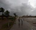
On June 2, wind speed will reach 40-50 kmph gusting to 60 over south Gujarat coast, with sea condition very likely to be "rough to very rough". On June 3-4, squally wind speed will reach 90-100 kmph gusting 110 kmph over Gujarat coasts, and the sea condition is very likely to be high to very high.

Data released by the IMD on Thursday showed that the mean minimum temperature (MMT) this December was 7.1 degrees Celsius.

As heavy rains batter several parts of west and south India, the meteorological department on Friday said isolated extremely heavy falls are very likely over Konkan, Goa and central Maharashtra in the next two days.

The rest of Maharashtra was very likely to get rain and thundershowers in isolated places during this period, the official informed.

The very severe cyclonic storm Tauktae is likely to intensify during the next 24 hours and reach the Gujarat coast on Monday evening, the India Meteorological Department (IMD) said.

India is likely to witness normal rainfall during the southwest monsoon season this year, the India Meteorological Department said on Thursday. Rainfall will be 96 per cent to 104 per cent of the Long Period Average (LPA) of 87 cm of the 1971-2020 period, it noted. Earlier, the IMD used to consider the LPA of 88cm of the 1961-2010 period.

The India meteorological department has issued an orange alert for Mumbai, Thane, Palghar and other coastal districts in Maharashtra, stating it is very likely that 'heavy to very heavy' rainfall will occur in isolated places in this region.

Heavy rains lashed Mumbai and its suburbs on Thursday, causing waterlogging on roads in some areas that led to traffic snarls and also delayed local train operations.
The depression, which was initially over west-central Bay of Bengal and adjoining areas, moved westward and intensified into a deep depression.

The weather department also said the national capital recorded only two rainy days this May, the lowest in 10 years.

The city went under cloud cover and witnessed incessant rainfall from afternoon, with parts of the city witnessing heavy rains and thunderstorms, civic officials said.

Even as Mumbaikars got some respite from the downpour on Friday morning, the India meteorological department has issued a red alert for the city and its suburbs warning that very heavy to extremely heavy rainfall is likely at isolated places during the day, the civic officials said.

India will receive normal monsoon this season, country's meteorological department said on Wednesday in its forecast for the Southwest monsoon that covers 75 per cent of the country, and thereby may bring much-needed respite to the economy, which is reeling under the catastrophic effect of the Covid-19 pandemic.

The India Meteorological Department on Wednesday issued an orange alert for Delhi, predicting 'heavy' to 'very heavy' rainfall in parts of the capital with winds gusting up to 60 kilometers per hour.

The city's 24-hour Air Quality Index, recorded at 4 pm every day, stood at 418, up from 334 the previous day, and it may trigger stringent restrictions under the third stage of the graded response action plan to mitigate hazardous conditions.

The Indian Meteorological Department has issued a forecast predicting significant precipitation in the city throughout the week, casting a shadow over the series opener.

The cyclonic storm is likely to make landfall between Bhitarkanika National Park and Dhamra Port in Odisha early Friday with wind speeds of up to 120 kilometres per hour (kmph), it said.

Skymet lowered its full season monsoon forecast to 'below normal' from 'normal', while the IMD is sticking to its earlier forecast that rains in June to September of 2018 would be 'normal' at 97 per cent of the LPA with a model error of +/-5 per cent.

India's crucial monsoon will be normal this year but with less heavier rains as the weather office on Friday marginally downgraded its earlier forecast.

A well-marked low-pressure area over southwest Bay of Bengal intensified into a depression on Thursday morning packing wind speed of 40-50 kmph as it moved towards the north Tamil Nadu coast, the weather office said.

The IMD has also issued a red-coded warning alert to the Odisha and West Bengal coasts.

The storm would continue to move north-northwestwards, intensify further and reach north Bay of Bengal near West Bengal and the adjoining north Odisha and Bangladesh coasts by the morning of May 26

The bounteous monsoon this year has already dumped 1159.4 mm of rainfall in Delhi till Thursday afternoon, the highest since 1964 and the third-highest ever, according to the IMD data

Cyclone Tauktae weakened into a 'depression' and lay centred over south Rajasthan and adjoining Gujarat region on Wednesday morning, the India Meteorological Department said.

Monsoon is likely to be 96 per cent of the long period average

This deterioration in air quality led to prompting enforcement of Stage II of the Graded Response Action Plan (GRAP) in the national capital.

Heatwave conditions are expected over northwest India during the next five days, with Punjab, Haryana, Rajasthan and Delhi predicted to bear the maximum impact, the India Meteorological Department (IMD) said on Thursday.

"This year, the Southwest Monsoon is likely to set over Kerala on May 31 with a model error of four days," the India meteorological department said on Wednesday.

Widespread rains lashed parts of Tamil Nadu on Thursday, prompting authorities to declare a holiday for schools in Chennai and many other districts.

Light to moderate rain in many areas with heavy rain at isolated places is likely to occur in West Bengal's coastal districts of North 24 Parganas, South 24 Parganas and Purba Medinipur.

Rains have been 5% below normal so far, but Met department sticks to its forecast

The Mungeshpur weather station recorded a high of 48.8 degrees Celsius, eight notches above the normal. It recorded a minimum temperature of 27.6 degrees Celsius, a notch above the season's average.

The minimum temperature in the national capital on Saturday settled at 10.2 degrees Celsius, three notches above the season's average, it said.

All 80 people stuck at Pali waterfall in Goa's Sattari taluka were rescued on Sunday by the state's Fire and Emergency Services and the police, an official said.

"Cyclone Nisarga is likely to become a severe cyclone in the next 12 hours. It will continue to move for the next six hours in a northerly direction along the coast, after that it will re-curve as a cyclone and cross Raigad and Daman-Raigad," Aanand Sharma, deputy director, IMD told ANI.

The IMD DG said there should not be an impression that climate change leads to rise in the temperature, but on the contrary, it leads to erratic weather.
The India Meteorological Department (IMD) seems to have taken a cautious stand over the World Meteorological Organisation's (WMO) projection of a 'poor monsoon' due to a probable 'El Nino' impact. The IMD did not agree with WMO's projections, saying, "El Nino and the progress of monsoon are not mutually exclusive events", and remained non-committal over its earlier projection of a "normal monsoon" for the June-September 2009 season.

Intense heat swept through east India and parts of the southern peninsular region on Thursday, testing power grids and prompting the Kerala government to order closure of educational institutions till May 6.
