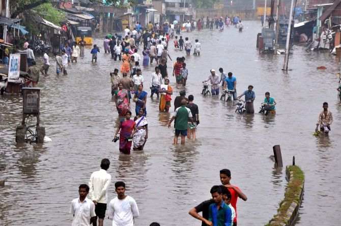
 Moderate to rather heavy rains are likely at many places over all districts of coastal Tamil Nadu and Puducherry on Monday as a low pressure area would form over Southwest Bay and adjoining southeast Bay of Bengal.
"A low pressure area would form over Southwest bay and adjoining Southeast bay during the next 24 hours," Director, Area Cyclone Warning Centre, Regional Meteorological Department, S R Ramanan told PTI.
Saturday's low trough at mean sea level over southwest bay and neighbourhood now lies over southwest bay and adjoining Sri Lanka coast, he said.
Another low trough lies over Southeast bay and adjoining South Andaman seas and under the influence, a low pressure area would form during the next 24 hours, he said.
Moderate to rather heavy rain is likely to occur at many places over all the districts of coastal Tamil Nadu and Puducherry on Monday, he said.
A Met bulletin said Dharmapuri recorded the lowest minimum temperature of 19 degree Celsius in the plains of Tamil Nadu. Also, there were scattered rains in the state.
Bhoothapandy (Kanyakumari District) and Papanasam (Tirunelveli District) recorded four cm and three cm of rain respectively. Parts of Kancheepuram, and Tiruvallur districts received between one to two cm.