Data provided by the satellites helps experts predict the level of rains till then, what to expect in the next few hours and even about the situation in the forests and the water reservoirs.
T E Narasimhan reports.

Photograph: PTI Photo
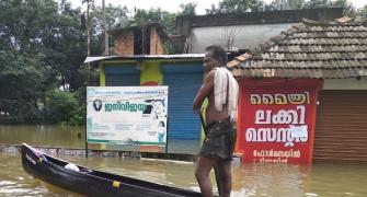
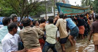
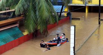
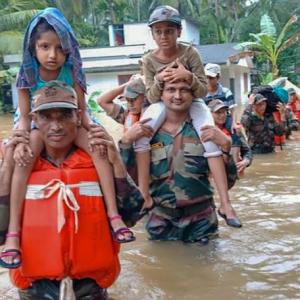
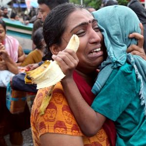
During the last fortnight's unprecedented floods and landslides in Kerala, there was technologically helpful support for the authorities via updates from the Indian Space Research Organisation and its various satellites.
A set of remote sensing and radar satellites has been taking pictures of various aspects, 400-800 km away from the earth. And, sending it back with supportive data.
Once processed, these helped experts to predict the level of rain till then, what to expect in the next few hours and even the situation in forests and reservoirs.
For instance, Resourcesat-2, launched in April 2011, is helpful in taking pictures of forests and other terrain, including water bodies.
ScatSat-1 tracks the wind, how it flows over the sea and over land, helping to forecast the weather. Insat-3DR, with other satellites, can communicate how clouds are positioned; with ScatSat-1, experts can conclude how fast these are moving. Insat satellites would send data every half an hour.
Microwave remote sensing techniques have an advantage in that electromagnetic radiation penetrates clouds and senses all surface hydrological characteristics.
The data from Scatsat-1 (launched September 2016) has been used to detect flood situations over India.
Merging of back-scattering and brightness temperature data help to delineate regions which are flooded, partially submerged or in different soil wetness conditions.
"When we have a good number of satellites, we know the situation yesterday and today. We will be able to assess the situation and come to an understanding on what to expect next.
"These periodical updates are helpful in situations like floods, when we can forewarn state governments," said M Annadurai, who was director of ISRO's U R Rao Satellite Centre till the end of last month.
Oceansat-2, Insat-3DR, Cartosat-2 and 2A and Resourcesat-2 are some of the satellites that are helping the country to know about flooding and other natural disasters.
While remote sensing satellites enable one to predict the weather, with wind flow and speed, moisture, clouds and other parameters, radar satellites help to see beyond the clouds to the ground situation, giving a larger picture.
Oceansat, Resourcesat and Cartosat are used to take pictures at a closer range, at lower altitudes.
This is helpful in identifying forest firer and like occurrences, taking better pictures than satellites from a distance.
Data sent from the remote terminals also help scientists to come to a conclusion on the ground situation.
The challenge for satellites closer to the earth is that they require more power to operate and are, therefore, heavier -- they need to carry larger solar panels.
This makes their life shorter as compared to those at orbits almost 800 km away from the Earth.
The ISRO has been working on technology to make these satellites less power consuming and, thus, smaller.