 | « Back to article | Print this article |
In PHOTOS: On the surface of Mars
NASA's new rover blasted off for an eight-month, 570 million-km journey to Mars.
NASA's six-wheeled, one-armed wonder, Curiosity, will use its jackhammer drill, rock-zapping laser machine and other devices to search for evidence that Earth's next-door neighbour might once have been home to the teeniest forms of life.
The 1-ton Curiosity -- 3 meters long, 2.7 meters wide and 2.1 meters tall at its mast -- is a mobile, nuclear-powered laboratory holding 10 science instruments that will sample Martian soil and rocks, and with unprecedented skill, analyse them right on the spot.
While Curiosity makes its way to Mars, rediff.com brings to you views of the Red Planet.
Click on NEXT to see more PHOTOS...
In PHOTOS: On the surface of Mars

This view combines exposures taken by Opportunity's panoramic camera (Pancam) on the 2,678th Martian day, or sol, of the rover's work on Mars before driving on that sol. The subsequent Sol 2678 drive covered 246 feet (75.26 meters), more than half of the remaining distance to the rim of the crater. Opportunity arrived at the rim during its next drive, on Sol 2681 (Aug. 9, 2011).
Click on NEXT to see more PHOTOS...
In PHOTOS: On the surface of Mars
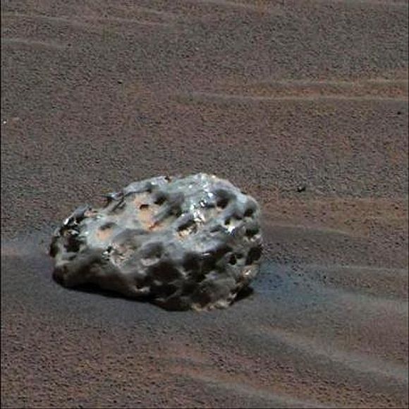
An iron meteorite on Mars in an image taken by NASA's Mars Exploration Rover "Opportunity" in January 2005.
Click on NEXT to see more PHOTOS...
In PHOTOS: On the surface of Mars
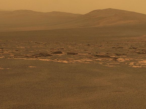
A portion of the west rim of Endeavour crater sweeps southward in this color view from NASA's Mars Exploration Rover Opportunity released in August 2011.
Click on NEXT to see more PHOTOS...
In PHOTOS: On the surface of Mars
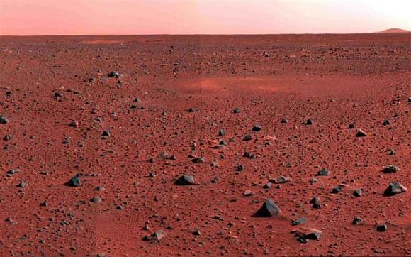
A January 2004 image mosaic taken by the Mars Exploration Rover Spirit's panoramic camera shows a slice of martian real estate southwest of the rover's landing site.
Click on NEXT to see more PHOTOS...
In PHOTOS: On the surface of Mars
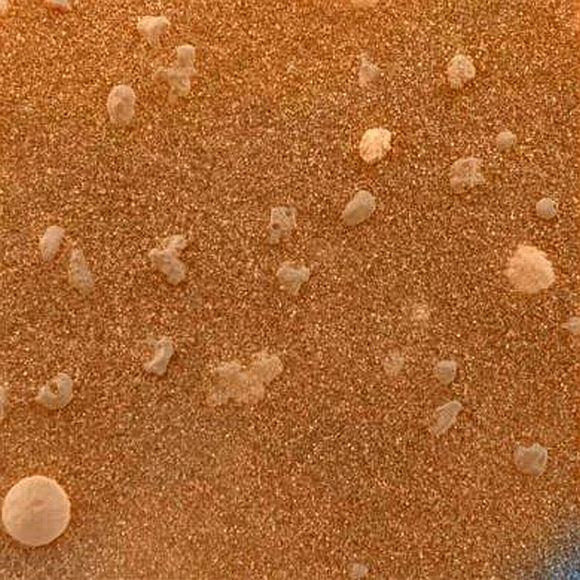
A magnified look at the martian soil near the Mars Exploration Rover Opportunity's landing site, Meridiani Planum, shows coarse grains sprinkled over a fine layer of sand, February 2004. The image roughly approximates the color a human eye would see.
Click on NEXT to see more PHOTOS...
In PHOTOS: On the surface of Mars
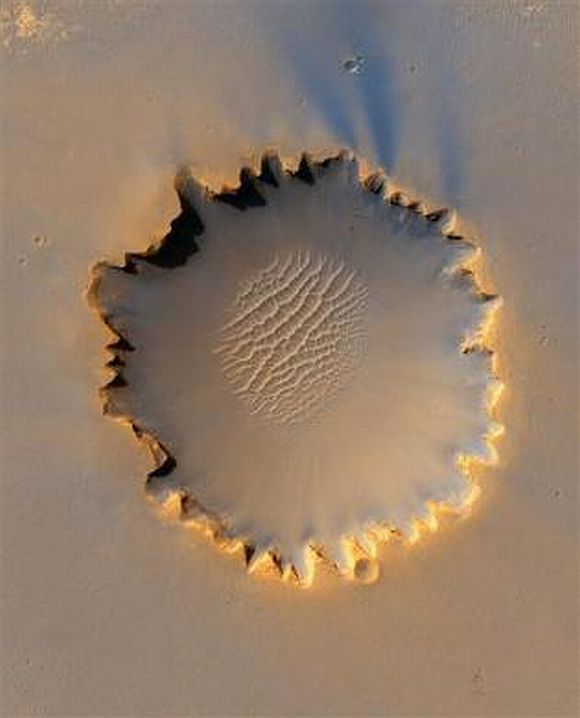
Mars' Victoria Crater at Meridiani Planum in an image taken by NASA's High Resolution Imaging Science Experiment camera and released October 6, 2006.
Click on NEXT to see more PHOTOS...
In PHOTOS: On the surface of Mars
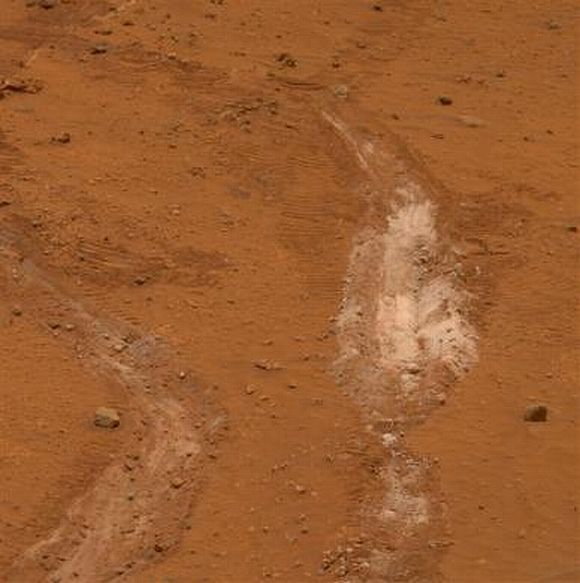
A view of a path of soil discovered by NASA's Mars Exploration Rover Spirit that scientists say suggests that long ago hot springs may have percolated on the Martian surface, providing an environment quite conducive to life.
Click on NEXT to see more PHOTOS...
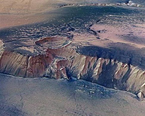
In PHOTOS: On the surface of Mars

Images taken by ESA's Mars Express of Echus Chasma in July 2008. Echus Chasma is an approximately 100 km long and 10 km wide incision in the Lunae Planum high plateau north of Valles Marineris, the Grand Canyon of Mars.
Click on NEXT to see more PHOTOS...
In PHOTOS: On the surface of Mars
A cliff, up to 4,000 m high, located in the eastern part of Echus Chasma, one of the largest water source regions on Mars, July 2008. Echus Chasma is the source region of Kasei Valles which extends 3,000 km to the north.
Click on NEXT to see more PHOTOS...
In PHOTOS: On the surface of Mars

The High Resolution Imaging Science Experiment (HiRISE) camera on NASA's Mars Reconnaissance Orbiter acquired this color image on March 9, 2011, of "Santa Maria" crater, showing NASA's Mars Exploration Rover Opportunity perched on the southeast rim on Mars, in this photograph released by NASA. The rover is the bluish speck at about the four o'clock position on the crater rim (with indicator arrow). North is up. Rover tracks are visible to the west of the crater.
Click on MORE to read related feature...