 | « Back to article | Print this article |
Centre ordered release of Rs 1,086 crore to four states as advance financial assistance for undertaking preventive and relief measures to deal with the cyclone.
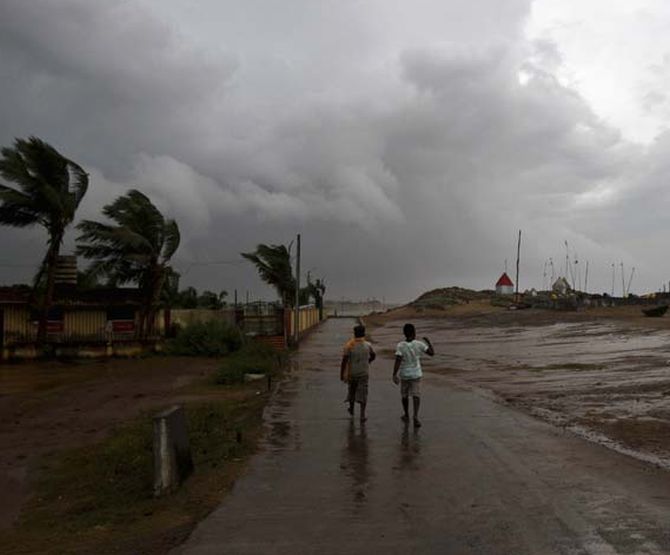
Cyclone 'Fani' is likely to intensify into an 'extremely severe cyclonic storm' by late night and can hit the Odisha coast by Friday afternoon, the India Meteorological Department said on Tuesday.
In its 12 pm bulletin, the Cyclone Warning Division of the IMD said Fani (pronounced as Foni) lays over southeast and adjoining southwest Bay of Bengal, about 830 km nearly south of Puri (Odisha) and 670 km south-southeast of Vishakhapatnam (Andhra Pradesh) and about 680 km northeast of Trincomalee (Sri Lanka).
"It is very likely to intensify further into an extremely severe cyclonic storm during the next 12 hours.
"It is very likely to move northwestwards till May 1 evening and thereafter recurve north-northeastwards and reach Odisha coast by May 3 afternoon with maximum sustained wind of speed 170-180 kilometers per hour gusting to 200 kmph," the IMD said.
The National Disaster Response Force and the Indian Coast Guard were put on high alert and the fishermen were asked not to venture into the sea, the Union Home Ministry said on Monday.
The wind speed of a cyclonic storm is 80-90 kilometres per hour with wind gusting up to 100 kmph.
In case of an 'extremely severe cyclonic storm', the wind speed goes up to 170-180 kmph and could gain the speed of 195-200 kmph.
Light to moderate rainfall at many places with heavy falls at isolated places is very likely over Kerala, at a few places over north coastal Tamil Nadu and south coastal Andhra Pradesh during the next 24 hours.
Heavy rainfall is very likely over north coastal Andhra Pradesh on Thursday and light to moderate rainfall at most places with heavy to very heavy rainfall at a few places a day later.
Odisha is expected to get light to moderate rainfall at many places from Thursday. South coastal Odisha is expected to receive heavy to very heavy rainfall on the same day.
Rainfall is likely to increase at most places with heavy to very heavy rains at a few places with 'extremely heavy falls' at isolated places over coastal Odisha and its adjoining districts of interior Odisha on Thursday.
Meanwhile, the Centre on Tuesday ordered release of Rs 1,086 crore to four states as advance financial assistance for undertaking preventive and relief measures to deal with the cyclone.
Following a decision of the National Crisis Management Committee (NCMC), the Ministry of Home Affairs has ordered for advance release of financial assistance of Rs 1,086 crore to the State Disaster Response Fund (SDRF) of four states , an official statement said.
Of the sanctioned amount, Odisha will receive Rs 340.87 crore, Tamil Nadu Rs 309.37 crore, West Bengal Rs 235.50 crore and Andhra Pradesh will get Rs 200.25 crore.
The move has been made to assist the states for undertaking preventive and relief measures in response to cyclonic storm 'Fani'.
The NCMC is the country's top body to deal with emergency situations.
The cyclonic storm is likely hit the Odisha coast between Puri and Kendrapara by Friday, a senior official said.
The India Meteorological Department (IMD) is yet to specify the exact location of landfall.
However, in its 12 pm bulletin, the Cyclone Warning Division of the IMD said Fani lays over southeast and adjoining southwest Bay of Bengal, about 830 km nearly south of Puri, 670 km south-southeast of Vishakhapatnam (Andhra Pradesh) and about 680 km northeast of Trincomalee (Sri Lanka).
"The IMD module indicates that cylone Fani is expected to make a landfall somewhere between Satapada or Chandrabhaga in Puri district and Gupti in Kendrapara late on May 3," Special Relief Commissioner (SRC) B P Sethi said.
According to a forecast issued by the US Navy, the cyclonic system is likely to cross Odisha through the coast, he said, adding, the exact location of the landfall will be clear on Wednesday after the cyclone recurves.
Image only for representation.