 | « Back to article | Print this article |
'Storms push a lot of water into land, then there is heavy rainfall due to the cyclone.'
'Along with this, we see the gradual rising of the sea level.'
'We see this during and after the latest Cyclone Tauktae.'
'This kind of overlapping events are increasing and we do not know much about how to tackle them.'
2019 saw Cyclone Vayu, one of the strongest tropical cyclones affecting the Saurashtra peninsula in western India.
2019 also saw Cyclone Kyarr, the second strongest tropical cyclone in the Arabian Sea, and one of the most intense tropical cyclones in North Indian Ocean history
In 2020, there was Cyclone Nisarga in the Arabian Sea.
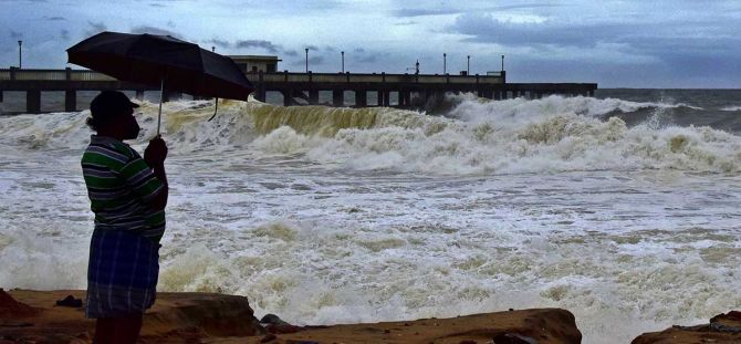
And now in 2021, the Arabian Sea saw the devastating Cyclone Tauktae.
Why is it that we see more cyclone formations in the Arabian Sea now, more than what we saw in the last four decades?
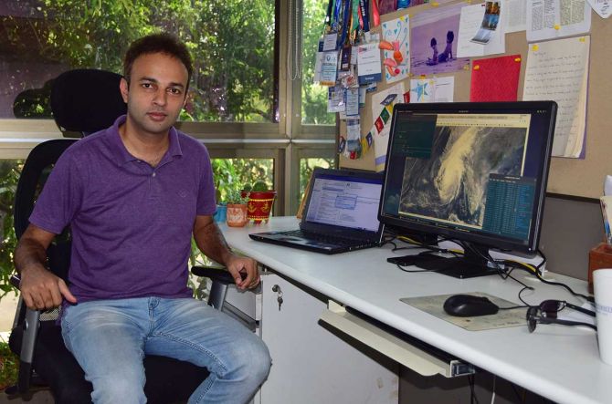
In this conversation with Rediff.com's Shobha Warrier, Dr Roxy Mathew Koll, climate scientist at the Indian Institute of Tropical Meteorology, Pune, explains the reasons behind the phenomenon.
"The west coast of India is not historically designed for this kind of continuous events. When the general pattern changes, we need to prepare the west coast for this kind of changes," Dr Koll says.
The first of a two-part interview:
We thought cyclonic storms were associated with the North East monsoon, in the Bay of Bengal. Of late, we see cyclonic storms in the Arabian Sea before the South West monsoon, and the latest is Cyclone Tauktae. What is the reason behind this?
Let me first talk about the relationship between monsoon and cyclones.
The South West monsoon generally starts from June and lasts till September.
Usually during the monsoon, we don't have cyclones. And the reason is, the monsoon winds do not allow the cyclones to form as cyclones develop vertically from the sea surface to around 10-12 km towards the upper atmosphere.
But during the monsoon, the winds move in one direction, and the upper atmospheric winds in another direction. This opposing wind pattern is what stops cyclones from developing vertically upwards during the monsoon.
So, generally during the monsoon and before the onset of monsoon, we do not have cyclones especially in Arabian Sea because the winds are stronger there, and they have already set in by then.
But in 2020, we saw Cyclone Nisarga just before the South West monsoon. And this year, we had Cyclone Tauktae.
One of the reasons why the Arabian Sea is changing is, the sea is warming quite faster.

Any particular reason why the Arabian Sea is warming faster?
The prime reason is global warming due to the increase in carbon emission as this carbon dioxide gets trapped in the atmosphere.
But where does the heat go?
More than 93% of the heat due to carbon emission is absorbed by the ocean.
And that is one reason we are not seeing the full impact of global warming.
At the same time, there is a limit for the oceans to absorb heat. Though oceans are deep, a lot of heat is absorbed by the surface of the ocean which results in the warming of the surface of the ocean.
Among all the oceans, the Indian Ocean is the warmest, and in the Indian Ocean, it is the western part which includes the Arabian Sea that is warming more rapidly.
Is there any particular reason why different oceans are warming differently?
There are multiple reasons for that.
One reason is the way the ocean currents and atmospheric circulation redistributes the heat. The currents are in such a way that the heat is distributed more to the western part of the Indian Ocean.
Another reason is, if we take the Atlantic Ocean and Pacific Ocean, both are open to the North and South Poles. So, there is a way to flush out the equatorial hot water to both in the north and the south.
On the other hand, the Indian Ocean is land-locked in the north, the east and the west. That is another reason why the heat that is amassed in the Indian Ocean does not get flushed out very fast.
Of course, this is the not the prime reason why the Indian Ocean is hotter.
So, is it because the Indian Ocean remains warmer that we see cyclonic storms in the Arabian Sea regularly now?
Cyclones always form over the 'warm pool' regions over the ocean.
'Warm pool' regions are where the temperature remains always above 28 degrees. For example, the Bay of Bengal, West Pacific, etc where cyclones form, have always been warm pool regions as the temperature is always above 28 degree Celsius.
But the Arabian Sea was not entirely a warm pool region until recently. But now because of an increase in the temperature, it has become a warm pool.

On one side of the Indian continent, there is the Bay of Bengal and on the other side is the Arabian Sea. Why is it that one is a warm pool region and the other is not?
One of the reasons is how the winds work. When you have strong winds over the water surface, there will be evaporation and the surface cools down.
The winds over the Arabian Sea are very strong compared to the winds over the Bay of Bengal.
So, that's why the Arabian Sea was around 2 degrees cooler than the Bay of Bengal?
Yes. That is one of the major reasons.
It is not just evaporation. When the winds blow over the Arabian Sea, it also mixes the sub surface water to the surface.
As you know, the sub-surface water is always cooler as it is not exposed to the sun. This also makes the Arabian Sea, especially the western parts where the winds are stronger, cooler than the Bay of Bengal.
But now, this part also has become a warm pool, almost on par with the Bay of Bengal.

What kind of environmental impact will this cause other than the cyclones we see of late?
Cyclones are formed in the warm pool region because their energy is fuelled by warm waters.
Warm water is a constant energy source because the heat capacity of water is large compared to air or land. So, water remains warmer for a longer time.
That's why it can sustain a cloud or cyclone formation for a long time. Hence storms and cyclones form in the western Indian Ocean including the Arabian Sea.
Not only cyclones, this results in heavy rainfalls during the monsoon time.
Our research shows that there is a three-fold increase in extreme rainfall (external link) events along the west coast and the central parts of India where the South West monsoon is active.
When you get more than 150 mm of rain in a day, we call it extreme rainfall.

In the last few years, we have had extreme rainfall during the monsoon...
Exactly.
So, it is not just cyclones; once the cyclone is over, it is time for extreme rainfall.
The problem is, the west coast of India is not historically designed for this kind of continuous events. When the general pattern changes, we need to prepare the west coast for these kind of changes.
Another factor is, the sea level is also rising, and warming has a role in this event too.
Generally, we are only aware of the sea level rising due to glaciers melting in the polar region and in the Himalayas.
Other than this, the sea level also rises because of warming.
The oceans are on an average four kilometres deep and when it warms, water expands. Because the Indian Ocean is warming rapidly, the expansion also is large. So, that also contributes to the rise in the sea level.
We call this kind of sea level rise as thermal expansion.
So, cyclones, heavy rainfall events and sea level rise can work together or even overlap, resulting in prolonged floods in the coastal region.
Storms push a lot of water into land, then there is heavy rainfall due to the cyclone. Along with this, we see the gradual rising of the sea level.
This is why we see floods in the coastal regions of Kerala, Karnataka, Goa, Maharashtra and Gujarat. We see this during and after the latest Cyclone Tauktae.
This kind of overlapping events are increasing and we do not know much about how to tackle them.
Until now, we have been forecasting rainfall separately, cyclone separately and not even bothered about the rising sea level.
Feature Presentation: Ashish Narsale/ Rediff.com