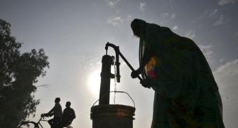
Till June 30, the southwest monsoon was 33 per cent lower than normal, which is among the worst in the last five years, with 28 of the 36 meteorological divisions recording deficient rain.

Kharif sowing this June has been a little more than 25 per cent of the normal of the last five years on account of the month being drier than usual.
But there is hope the rains will pick up in July and August because the southwest monsoon is set for revival over the central and northern parts of the country.
Till June 30, the southwest monsoon was 33 per cent lower than normal, which is among the worst in the last five years, with 28 of the 36 meteorological divisions recording deficient rain.
As a result, the sowing of kharif crops till Friday (June 28), according to the government data, took place in around 14.66 million hectares, which was 9.53 per cent less than in the same period last year and 25.45 per cent less than the average of the corresponding period in the last five years.
Among major crops, the acreage under pulses till June 28 was 61.39 per cent less than in the same period last year and 69.68 per cent less than the average of the last five years.
For coarse cereals, the corresponding figures are 10.69 per cent and 25.31 per cent.
Major varieties of pulses have taken a hit, with the arhar acreage almost 81 per cent less than the average of the last five years.
The cotton acreage till June 28 was 15.90 per cent less than in the same period last year and almost 41 per cent less than the average of the last five years.
In oilseeds too, the acreage was almost 45 per cent less the normal of the last five years.
The water levels in the 91 major reservoirs of the country continued to fall in June.
During the week ended June 27, the content was 26.3 billion cubic metres (BCM), which was 11.7 per cent lower than in the same period last year.
The levels dropped from 30.6 BCM on June 6.
However, the southwest monsoon, which was delayed by more than a week and then entered a prolonged lull phase due to Cyclone Vayu, has revived in parts of Western and Central India.
Jatin Singh, managing director of Skymet, said on Sunday a monsoon surge was expected from June 30 to July 15 with a short break in the middle of the period.
“This spell will be a result of a low-pressure area likely to form in the Bay of Bengal.
“Odisha, North Coastal Andhra Pradesh, South Chhattisgarh, northern parts of Telangana, South Madhya Pradesh, Vidarbha, parts of Madhya Maharashtra, Southwest Madhya Pradesh, North Madhya Maharashtra, South Rajasthan and Gujarat will benefit the most from this spell,” Singh said.
Madan Sabnavis, chief economist, CARE Ratings, told Business Standard: “The distribution of rain and the progress of kharif sowing will be the key determinants of crop production this year. Any further big break in the rains in the next two months could be disastrous.”
K Sathi Devi, a senior official of the India Meteorological Department (IMD), had forecast July rain to be normal at 95 per cent of the Long Period Average (LPA), with a model error of plus and minus 9 per cent.
Mahesh Palawat, chief meteorologist, Skymet, said. “By the end of July, global weather models are showing a further weakening of El Nino.”
Photograph: Reuters