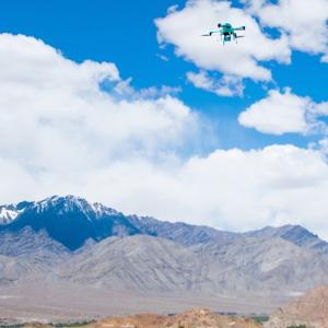
The Centre has launched a pilot project called Kisan, through which it will use satellite- and drone-based imaging and other geospatial technology to get timely and accurate data on crop yields in select districts.

To reduce the delay in settling insurance claims for crop damage, the Centre plans to use drones, satellite-based imaging, and geospatial technology to get timely and accurate data on yields. (Geospatial relates to or denotes data that is associated with a particular location.)
At present, yield loss due to natural calamity is calculated based on field reports and assessment of crop-cutting experiments by district and block agriculture officers.
Since these reports are often mired in inconsistencies, insurers end up processing inadequate claims.
The Centre has launched a pilot project called Kisan, through which it will use satellite- and drone-based imaging and other geospatial technology to get timely and accurate data on crop yields in select districts.
It has also launched an Android-based app to collect hailstorm data.
The app will be used by state agriculture officials and the data will help the Union agriculture ministry in fast assessment of damage to crops because of hailstorm.
"The crop insurance claim is calculated on the basis of crop cutting experiments. However, there has always been a problem in getting timely and accurate data, due to which payment of claims to farmers were getting delayed. A new programme Kisan is being launched on a pilot basis to address this issue," Minister of State for Agriculture Sanjeev Kumar Balyan told reporters.
Initially, the pilot study would be carried out in rice and cotton fields in four districts during the ongoing kharif season in Karnataka (Shimoga district), Maharashtra (Yavatmal), Haryana (Kurukshetra) and Madhya Pradesh (Seoni), he said.
It will also be carried out during the 2015-16 rabi season in eight districts in the same states to assess the crop yields of rice, wheat and sorghum, the minister said, adding the programme would be scaled up across the country after assessing the results.
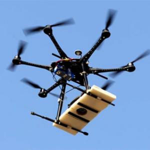
The programme envisages the use of high-resolution remote-sensing data both from satellite- and drone-based imaging, sophisticated modelling activity and other geospatial technology for improving the accuracy of crop yield estimation through more efficient crop cutting experiments.
Block-level yield estimation, development of a new index-based insurance approach, and using remote sensing data are also envisaged under the project.
The programme will be jointly conducted by Mahalanobis National Crop Forecast Centre, Indian Space Research Organisation (Isro), India Meteorological Department, CCAFS, state agriculture departments, and remote sensing centres.
On the hailstorm app, the minister said, "Hailstorms cause large-scale damage to standing crops. However, at present, there is no comprehensive approach to collect hailstorm data. To overcome this, an Android app has been developed with the support of Isro."
The app can be used through smartphones for collection of hailstorm data along with photographs and locations and can be uploaded real-time on ISRO's Bhuvan server.
The app will be used by state agriculture department officials for data collection. Even farmers can download the app and send pictures of hailstorm.
EYE IN SKY
Yield loss due to natural calamity is calculated based on field reports and assessment of crop-cutting experiments by district and block agriculture officers
Since these reports are often mired in inconsistencies, insurers end up processing inadequate claims
The Centre has launched a pilot project called Kisan, through which it will use satellite- and drone-based imaging and other geospatial technology to get timely and accurate data on crop yields in select districts